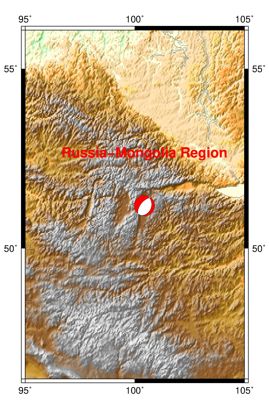
1/11/2021 Russia-Mongolia Border 6.8
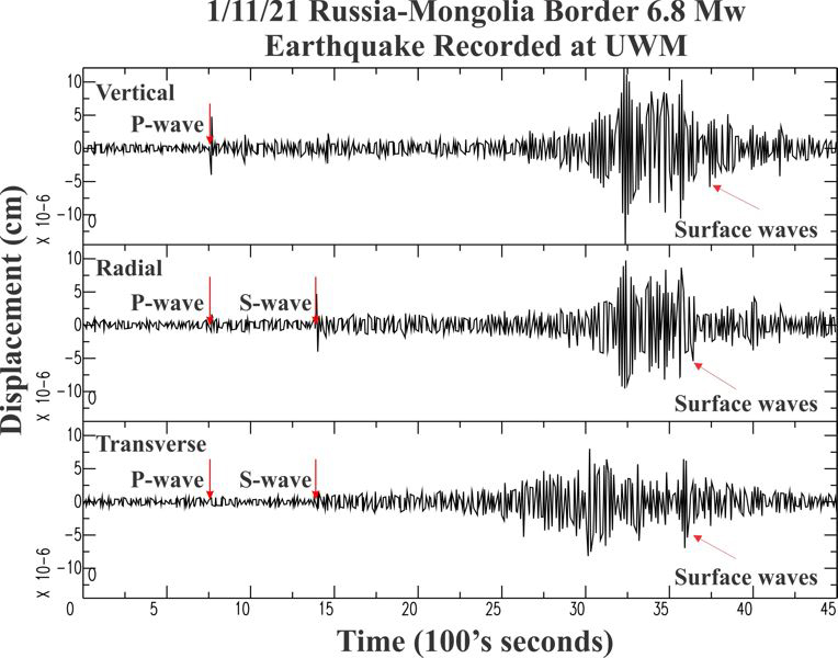

| Earthquake Details | Seismogram Explanation |
|---|---|
| Location: Russia-Mongolia Border | P-wave: 21:45:55 UTC; 3:45:55 pm CST |
| Date: January 11, 2021 | S-wave: 21:56:07 UTC; 3:56:07 pm CST |
| Time: 21:32:58 UTC; 3:32:58 pm CST | The vertical axis is in units of displacement in centimeters. |
| Latitude: 51.24 N | The horizontal axis is in units of time in seconds. |
| Longitude: 100.44 E | The beginning of the file is the origin of the event. |
| Magnitude: 6.8 Mw | |
| Depth: 11.5 km | |
| Distance: 85.41 degrees (~5,781 miles from Milwaukee) |