1/21/2021 Philippine Island Region 7.0
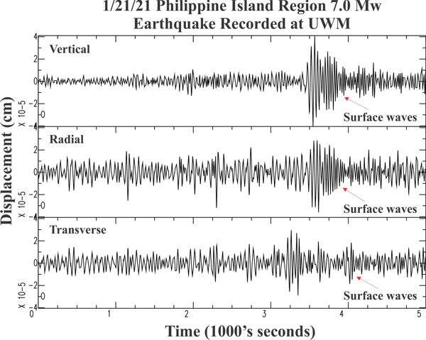


| Earthquake Details | Seismogram Explanation |
|---|---|
| Location: Philippine Island Region | Pdiff-wave: not verified. |
| Date: January 21, 2021 | Sdiff-wave: not verified. |
| Time: 12:23:05 UTC; 6:23:05 am CST | The vertical axis is in units of displacement in centimeters. |
| Latitude: 5.01 N | The horizontal axis is in units of time in seconds. |
| Longitude: 125.52 E | The beginning of the file is the origin of the event. |
| Magnitude: 7.0 Mw | |
| Depth: 80.5 km | |
| Distance: 122.24 degrees (~8,774 miles from Milwaukee) |