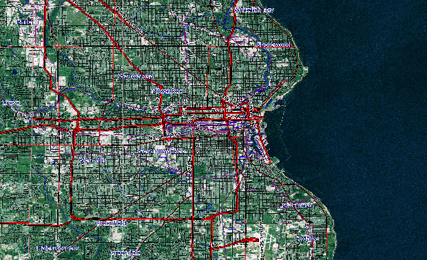
Geographic Information Science and Remote Sensing focuses on using geospatial technology to understand how natural and human forces interact across the Earth’s surface. We explore everything from mapping environmental change to analyzing urban patterns, while also examining how these tools shape social and cultural dynamics. As a fast-growing field, GIS offers strong career prospects through 2030, with a wide range of opportunities highlighted on the ESRI careers page.

Faculty

Photo of Woonsup Choi
  • Professor, Geography
  • Affiliated Faculty, Northwestern Mutual Data Science Institute
Photo of Mark D. Schwartz
  • Distinguished Professor, Geography
Photo of Zengwang Xu
  • Associate Professor, Geography

UWM Land Acknowledgement: We acknowledge in Milwaukee that we are on traditional Potawatomi, Ho-Chunk and Menominee homeland along the southwest shores of Michigami, North America’s largest system of freshwater lakes, where the Milwaukee, Menominee and Kinnickinnic rivers meet and the people of Wisconsin’s sovereign Anishinaabe, Ho-Chunk, Menominee, Oneida and Mohican nations remain present.   |   To learn more, visit the Electa Quinney Institute website.