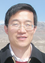
Changshan Wu
Web Site: http://people.uwm.edu/cswu/
Education
PhD, Geography, The Ohio State University, 2003
MS, Institute of Remote Sensing Applications, Chinese Academy of Sciences, 1999
BS, Urban and Environmental Sciense, Peking University, China, 1995
Office Hours
M 11:00 am – 12:00 pm
Courses Taught
Geog 403 – Remote Sensing: Environmental and Land Use Analysis Syllabus
Geog 430 – Geography of Transportation Syllabus
Geog 525 – Geographic Information Science Syllabus
Geog 547 – Spatial Analysis Syllabus
Geog 625 – Intermediate Geographic Information Science Syllabus
Geog 725 – Advanced Geographic Information Science: Geographic Modeling Syllabus
Geog 750 – Remote Sensing and Urban Analysis Syllabus
Research Interests
I am a broadly trained geographer with substantive interests in remote sensing, geographic information science, spatial analysis, and their applications in urban environments. Specially, my research focuses on two aspects: 1) remote sensing image analysis and applications, especially for urban impervious surface and population estimation, as well as urban growth modeling, and 2) spatial analysis and modeling, and their applications in housing market analysis, public health, and transportation studies.
One emphasis of my research is to develop innovative methods for better extracting urban biophysical and socio-economic information, and applying the derived information for planning and management of urban and natural environments. Especially, my research in the urban remote sensing field includes 1) urban imperviousness estimation, in particular using the spectral mixture analysis method, 2) small area population interpolation and estimation using high-resolution remote sensing and GIS dataset, and 3) urban growth monitoring and modeling using spatial modeling techniques. In addition to remote sensing and urban analysis, my other research area involves GIS and spatial modeling (spatial optimization, spatial statistics, etc.) and their applications in housing market analysis, public health, and transportation studies.