Our larger buoy platforms support either surface or underwater cameras that capture images every 10-15 minutes and the latest available images can be viewed below.
Data from these buoys can be viewed on GLOS’s new cloud-based platform page, Seagull. Make yourself an account, tag these buoys as a favorite, and don’t forget to submit some feedback using the orange bar at the top of the page. They love hearing from our dedicated users and are working closely with their development team to make Seagull a user friendly one-stop-shop website for all your Great Lakes observation needs.

Atwater 20-meter Buoy Dashboard
“The Atwater buoy has been great in determining what the lake looks like before making a commute to run a small boat out to McKinley. I use the data on a daily basis and think it’s a great tool!“
– Buoy Survey Response, 2021
DEPLOYED April 18, 2024 @ 11AM CDT
The Atwater 20-meter buoy (ATW20) is located approximately 2 km offshore of Milwaukee’s Atwater Beach in Lake Michigan. A two-point mooring system secures the buoy over sand and rock substrate in 20m of water. The solar-powered buoy is equipped with a weather station and wave sensor that collect data every 30 min, as well as a vertical string of temperature sensors, a downward-facing current profiler, a surface water quality sonde, and a cellular modem for real-time data communication.


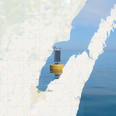
Green Bay Buoy Dashboard
Target Deployment: Mid-July 2024
The Green Bay buoy (GB17) is located approximately 40 km northeast of the mouth of the Fox River in southern Green Bay. The CB-1500 coastal data buoy is secured by a two-point mooring system over a mud substrate in 13 meters of water. The solar-powered buoy is equipped with a weather station and wave sensor that collect data every 30 min, as well as a vertical string of temperature sensors, a downward-looking current profiler, a surface water quality sonde, a high resolution fluorometer, and a cellular modem for real-time data communication.
“We have a recreational use boat located on the Suamico River and use the bay of Green Bay regularly during the summer months. Our interest is basically insuring safe use of the Green Bay/Lake Michigan waterways, anchorages and harbors when cruising. The data you are providing is valuable when making our cruising decisions. Thank you for the great service!“
– Buoy Survey Response, 2021
Sleeping Bear Buoy Dashboard
“I’ve been using these for years and trust them 100% over any other weather reports. We go out fishing in the dark and checking these has kept us safe for years!!! Not to mention catching a few fish. Lol.”
– Buoy Survey Response, 2021
DEPLOYED June 4, 2024 @ 12PM EDT
The National Parks Service at Sleeping Bear Dunes National Lakeshore (SLBE) in collaboration with UWM-SFS operates a water quality and meteorological buoy in Good Harbor Bay, just off shore of SLBE, in Lake Michigan. The buoy provides real-time weather, wave, temperature, and water quality data as well as a benthic imaging for ongoing research and outreach.
Thanks for dropping by – Enjoy the view!
Please feel free to report any data/image glitches to your friendly buoy tech and site host, Jessie Grow, at jgrow@uwm.edu.