| Earthquake Details |
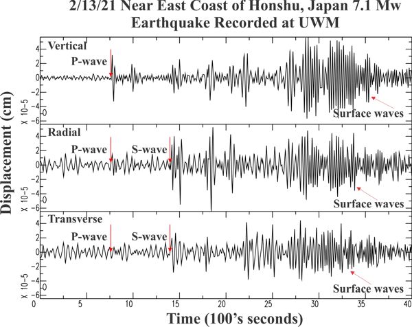
Seismogram Explanation |
| Location: Near East Coast of Honshu, Japan |
P-wave: 14:20:30 UTC; 8:20:30 am CST |
| Date: February 13, 2021 |
S-wave: 14:31:06 UTC; 8:31:06 am CST |
| Time: 14:07:49 UTC; 8:07:49 am CST |
The vertical axis is in units of displacement in centimeters. |
| Latitude: 37.69 N |
The horizontal axis is in units of time in seconds. |
| Longitude: 141.99 E |
The beginning of the file is the origin of the event. |
| Magnitude: 7.1 Mw |
|
| Depth: 60.5 km |
|
| Distance: 87.42 degrees (~5,917 miles from Milwaukee) |
|