2/10/2021 Southeast of Loyalty Islands 7.5

| Earthquake Details | Seismogram Explanation |
|---|---|
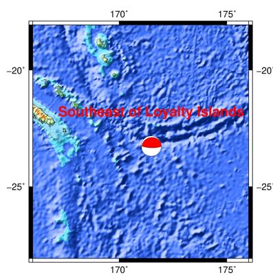
| Location: Southeast of Loyalty Islands | Pdiff-wave: not verified. |
| Date: February 10, 2021 | Sdiff-wave: not verified. |
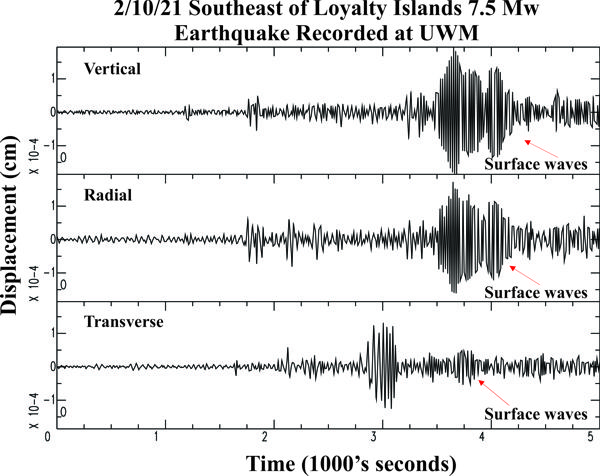
| Time: 13:20:00 UTC; 7:20:00 am CST | The vertical axis is in units of displacement in centimeters. |
| Latitude: -23.28 S | The horizontal axis is in units of time in seconds. |
| Longitude: 171.49 E | The beginning of the file is the origin of the event. |
| Magnitude: 7.5 Mw | |
| Depth: 25.5 km | |
| Distance: 113.18 degrees (~7,661 miles from Milwaukee) |