| Earthquake Details |
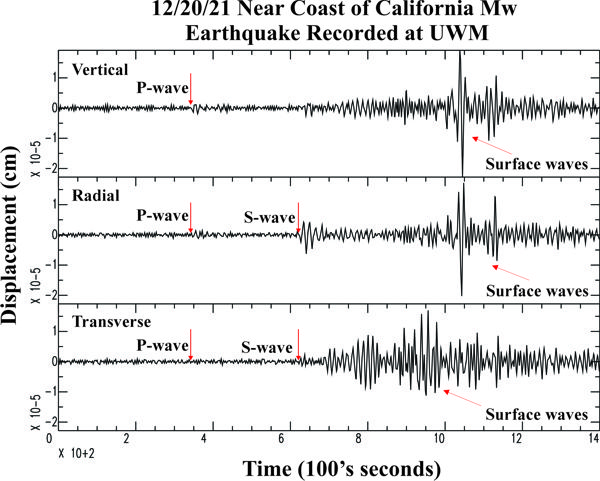
Seismogram Explanation |
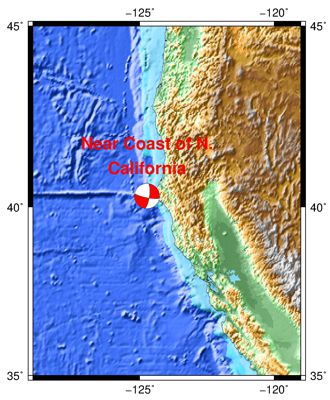
| Location: Near Coast of N. California |
P-wave: 20:16:00 UTC; 2:16:00 pm CST |
| Date: December 20, 2021 |
S-wave: 20:20:39 UTC; 2:20:39 pm CST |
| Time: 20:10:18 UTC; 2:10:18 pm CST |
The vertical axis is in units of displacement in centimeters. |
| Latitude: 40.32 N |
The horizontal axis is in units of time in seconds. |
| Longitude: 124.74 W |
The beginning of the file is the origin of the event. |
| Magnitude: 6.2 Mw |
|
| Depth: 39.0 km |
|
| Distance: 27.43 degrees (~1,856 miles from Milwaukee) |
|