12/14/21 Flores Sea 7.3
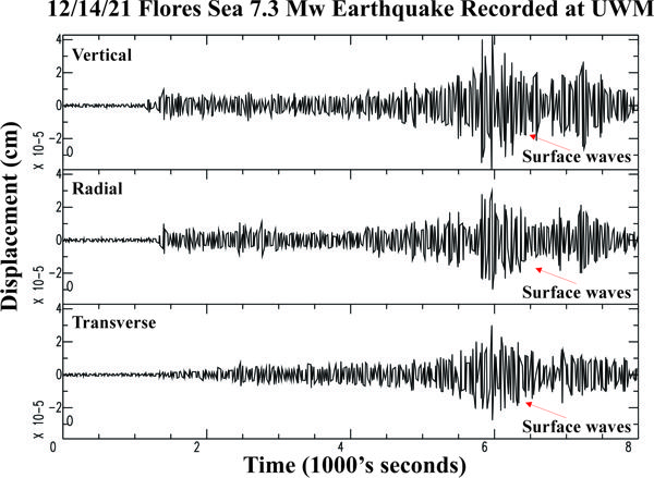
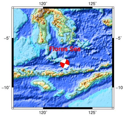

| Earthquake Details | Seismogram Explanation |
|---|---|
| Location: Flores Sea | P-diff wave not verified |
| Date: December 14, 2021 | S-diff wave not verified |
| Time: 03:20:24 UTC; 9:20:24 pm CST (local 12/13/21) | The vertical axis is in units of displacement in centimeters. |
| Latitude: 7.6 S | The horizontal axis is in units of time in seconds. |
| Longitude: 122.20 E | The beginning of the file is the origin of the event. |
| Magnitude: 7.3 Mw | |
| Depth: 17.5 km | |
| Distance: 135.79 degrees (~9,192 miles from Milwaukee) |