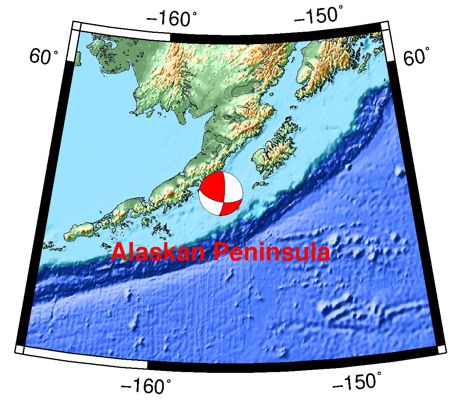
10/11/21 Alaskan Peninsula 6.9
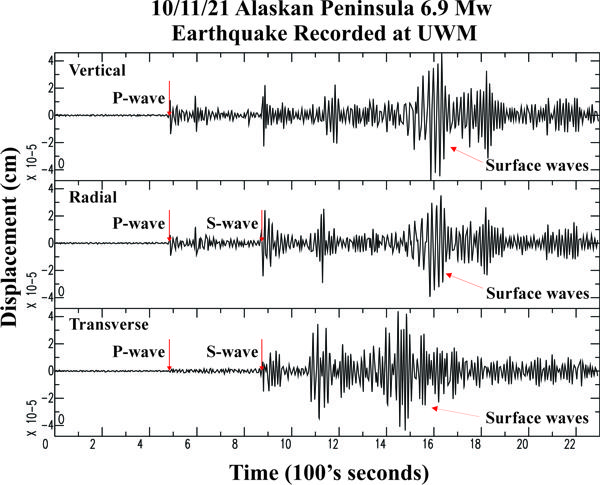

| Earthquake Details | Seismogram Explanation |
|---|---|
| Location: Alaskan Peninsula | P-wave: 9:18:28 UTC; 4:18:28 am CDT |
| Date: October 11, 2021 | S-wave: 9:24:58 UTC; 4:24:58 am CDT |
| Time: 09:10:24 UTC; 4:10:24 am CDT | The vertical axis is in units of displacement in centimeters. |
| Latitude: 56.26 N | The horizontal axis is in units of time in seconds. |
| Longitude: 156.55 W | The beginning of the file is the origin of the event. |
| Magnitude: 6.9 Mw | |
| Depth: 60.5 km | |
| Distance: 44.31 degrees (~2, 093 miles from Milwaukee) |