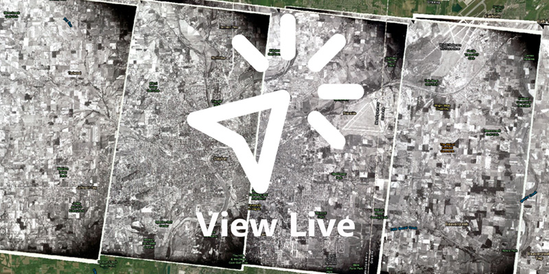
The Operation Bird’s Eye web mapping application is a discovery tool for exploring this unique collection of photographs. This application allows the user to view the entire span of aerial photos in their corresponding location on a present day base map of the United States. Users can select individual photos to view or use a wiping function to visualize changes in the landscape.
Background
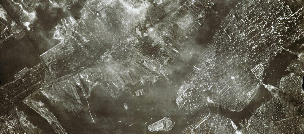
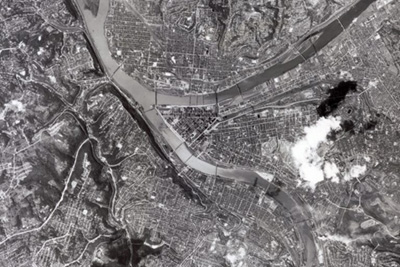
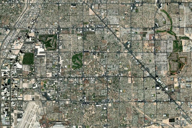
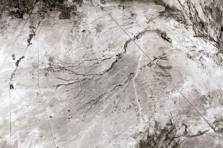
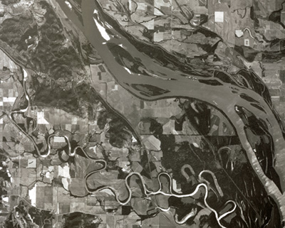
Operation Bird’s Eye is a photographic collection of nearly 400 overlapping aerial images which form a continuous strip spanning the United States from coast to coast. Beginning in Ventura, California and ending over Long Island, New York, these nine by nine inch prints capture a sliver of the American landscape as it looked in 1948. The images were captured during one continuous flight, and when joined together the physical prints stretch 192 feet, showing a slice of land 2,700 miles long. Notable locations include: Pittsburgh, Columbus, Dayton, Las Vegas, Indianapolis, Mississippi River, Hoover Dam, Grand Canyon, Kansas City, and Manhattan.
This collection offers a unique opportunity to understand how the American landscape changed through the second half of the twentieth century. Taken shortly after the end of World War II, these images capture the moment immediately preceding the onset of rapid changes, including development of the interstate system, urban renewal, and vast suburban expansion.
The flight from which these images were captured took off from the Air Force Flight Test Center (now Edwards Air Force Base) in Muroc, California at 7:40 AM local time on September 1, 1948, first gaining altitude out over the Pacific Ocean before turning east. The plane was a Republic XR-12, an experimental aircraft of which only two were ever built. It was outfitted with K-17 cameras able to shoot a continuous roll of film up to 200 frames. The camera shot at 50 second intervals throughout the duration of the flight, at a constant altitude of 40,000 feet, resulting in a field of vision of around 130 square miles.
The purpose of the XR-12 was photo reconnaissance, and Operation Bird’s Eye was meant as a demonstration of its capabilities. The plane, able to fly high and fast enough to avoid conventional enemy aircraft and fighters, was essentially a flying photography laboratory, with the crew able to process film mid-flight. The Operation Bird’s Eye flight broke records as it crossed the continent, capturing the longest span of aerial photos ever accumulated in a single trip to that point. After 6 hours and 55 minutes, the crew landed at Mitchel Field in Garden City, New York on Long Island.
The mission garnered public attention at the time, with Life Magazine featuring the story in its November 29, 1948 issue and the film strip itself being displayed at the 1948 Air Force Association Convention in New York City. The Republic XR-12, however, was retired from Air Force testing by 1952, having been quickly supplanted by new planes with jet engines featuring expanded capabilities. The plane that flew the Operation Bird’s Eye mission was lost to a mid-flight engine fire later in 1948 along with 2 members of the 7 man crew.