The Digital Collections at the UWM Libraries include over 190,000 photographic images, maps, and books drawn from the collections of the American Geographical Society Library, the Archives, Special Collections, and the Curriculum Collection.

Afghanistan: Images from the Harrison Forman Collection contain images that document the life and culture of Afghanistan in the 1950s and 1960s.

Africa presents images from the holdings of the American Geographical Society (AGS) Library. The selection focuses on the countries of southern and eastern Africa.
This collection presents 143 images and documents from Anna Estelle Paddock's work for the Young Women's Christian Association in China from 1905-1913.
Selections from the Records of the American Geographical Society of New York, founded in 1851, the oldest geographical organization in the U.S.

Asia and Middle East presents over 30,000 images (and counting) from the holdings of the American Geographical Society Library.
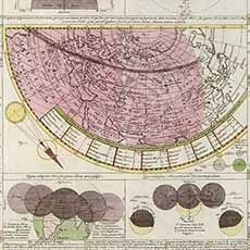
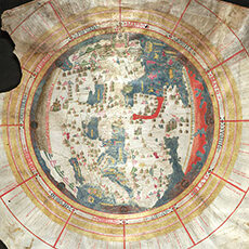
The Atlas Novus Coelestis (1742) is the major work of Johann Gabriel Doppelmayr. Also featured is the Grosser Atlas Uber die Ganze Welt, 1731.

Cities Around the World presents over 6,100 photographic images from the slide collections of the American Geographical Society Library.

This collection of photographer and filmmaker Dick Blau’s ethnographic projects includes over 500 images from Blau’s published work.
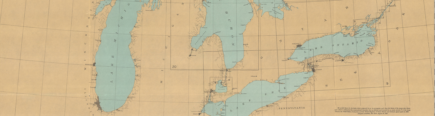
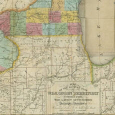
The Digital Map Collection currently contains over 5,000 maps, ranging from early maps of Asia to historical maps of Wisconsin and many other cities and sites.
Early Imprints on Wisconsin, 1836-1860 includes printed works on the Territory and State of Wisconsin published before the American Civil War in the UWM Libraries

Europe presents images from the extensive holdings of the American Geographical Society (AGS) Library, focusing on the countries of Europe.

The digital collection includes a selection of French World War I posters from the holdings of the AGSL.
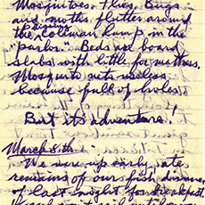
Harrison Forman was a prominent photojournalist and world traveler and a Fellow of the American Geographical Society. The diaries cover the period from 1932-1973.

Images of Russia and Caucasus Region 1929-1933 presents over 800 images and 21 films, particularly of rural areas in Georgia and Dagestan.
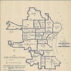
This collection features maps housed at the City of Milwaukee’s official records center and document repository, the Milwaukee Municipal Research Center (MRC).

This collection presents 90 images documenting the beginning of World War II in Poland, in late August and early September 1939
AGSL Digital Photo Archive - North and Central America presents images from the holdings of the American Geographical Society (AGS) Library.
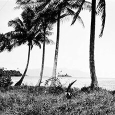
AGSL Digital Photo Archive - Oceania presents images from the holdings of the American Geographical Society (AGS) Library.
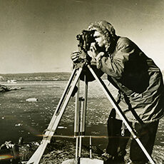
The Polar Exploration collection includes 628 images documenting several expeditions to the polar regions from late 19th century to mid-20th century.
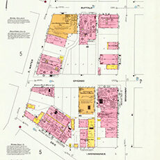
The Digital Sanborn Maps of Milwaukee 1894 and 1910 collection includes two atlases of the fire insurance maps of Milwaukee produced by the Sanborn Map Company.

AGSL Digital Photo Archive - South America presents images from the holdings of the American Geographical Society (AGS) Library.
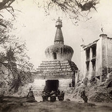
The digital collection presents historical maps and images of Tibet from the holdings of the American Geographical Society (AGS) Library.

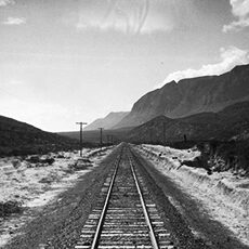
Transportation Around the World: 1911-1993 presents over 650 photographic images from the collections of the American Geographical Society Library.
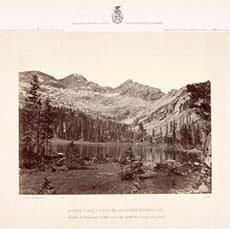
The Western Photograph Collection presents 250 images from the American Geographical Society Library, by Timothy H. O’Sullivan (1840-1882)