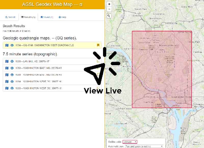
The Geodex software, developed during the 1980s at the American Geographical Society Library and maintained ever since, allows for rapid entering and searching of records for paper maps in large series. It now serves as the primary map index database for most of the large national, international, and nautical chart sets in the AGSL collection, containing tens of thousands of individual map records.
Developing a searchable Web map to search Geodex records had been on the library’s radar for a while. Eager to develop his mapping and programming skills, Ben Schroeder volunteered to develop the application as a culmination of all he’d learned as a GIS Intern at the AGSL.
The application was built using Leaflet, the Esri Leaflet extension (to easily query the ArcGIS Server), jQuery, Bootstrap, and Sass. As with all of Ben’s projects, code is annotated and available to view on Github