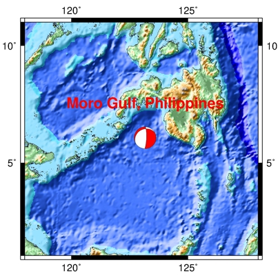
| Earthquake Details |
Seismogram Explanation |
| Location: Moro Gulf, Philippines 7.1 |
Pdiff-wave: not verified |
| Date: July 11, 2024 |
Sdiff-wave: not verified |
| Time: 02:13:17 UTC; 9:13:17 pm CDT (local 7/10/24) |
The vertical axis is in units of displacement in centimeters. |
| Latitude: 6.07 N |
The horizontal axis is in units of time in seconds. |
| Longitude: 123.16 W |
The beginning of the file is the origin of the event. |
| Magnitude: 7.1 Mw |
This event was very deep, hence the lack of surface waves. |
| Depth: 630.5 km |
|
| Distance: 123.37 degrees (~8,351 miles from Milwaukee) |
|