12/29/2021 Indonesia 7.3
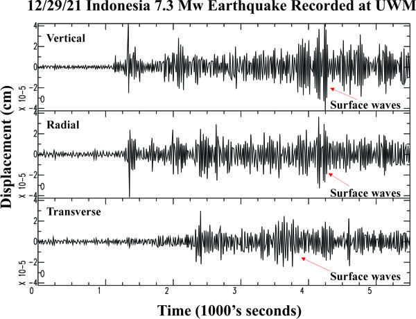

| Earthquake Details | Seismogram Explanation |
|---|---|
| Location: Indonesia | P-diff wave not verified |
| Date: December 29, 2021 | S-diff wave not verified |
| Time: 18:25:51 UTC; 12:25:51 pm CST | The vertical axis is in units of displacement in centimeters. |
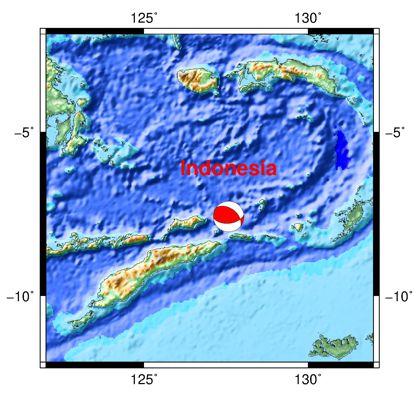
| Latitude: 7.59 S | The horizontal axis is in units of time in seconds. |
| Longitude: 127.58 E | The beginning of the file is the origin of the event. |
| Magnitude: 7.3 Mw | |
| Depth: 166 km | |
| Distance: 132.84 degrees (~8,992 miles from Milwaukee) |