| Earthquake Details |
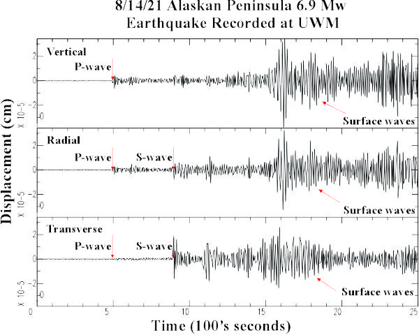
Seismogram Explanation |
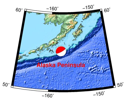
| Location: Alaskan Peninsula |
P-wave: 12:05:58 UTC; 7:05:59 am CDT |
| Date: August 14, 2021 |
S-wave: 12:12:37 UTC; 7:12:37 am CDT |
| Time: 11:57:44 UTC; 6:57:44 am CDT |
The vertical axis is in units of displacement in centimeters. |
| Latitude: 55.08 N |
The horizontal axis is in units of time in seconds. |
| Longitude: 157.54 W |
The beginning of the file is the origin of the event. |
| Magnitude: 6.9 Mw |
This is an aftershock from the larger 8.2 event on 7/29 |
| Depth: 23.5 km |
|
| Distance: 45.14 degrees (~3,056 miles from Milwaukee) |
|