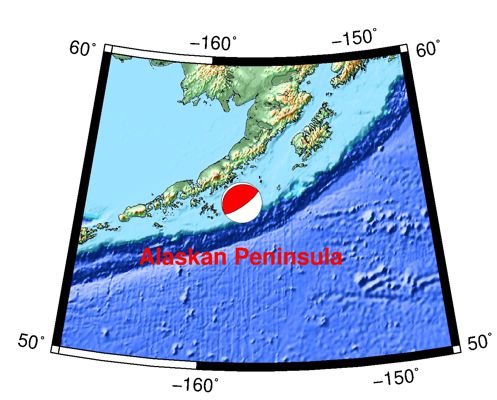
7/29/2021 Alaskan Peninsula 8.2
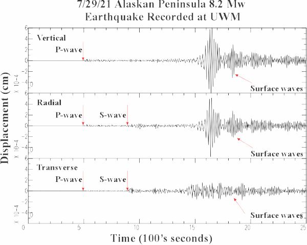

| Earthquake Details | Seismogram Explanation |
|---|---|
| Location: Alaskan Peninsula | P-wave: 06:24:01 UTC; 1:24:01 am CDT |
| Date: July 29, 2021 | S-wave: 06:30:39 UTC; 1:30:39 am CDT |
| Time: 06:15:47 UTC; 1:15:47 am CDT | The vertical axis is in units of displacement in centimeters. |
| Latitude: 55.32 N | The horizontal axis is in units of time in seconds. |
| Longitude: 157.84 W | The beginning of the file is the origin of the event. |
| Magnitude: 8.2 Mw | |
| Depth: 35.5 km | |
| Distance: 45.24 degrees (~3,062 miles from Milwaukee) |