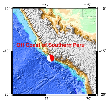
| Earthquake Details |
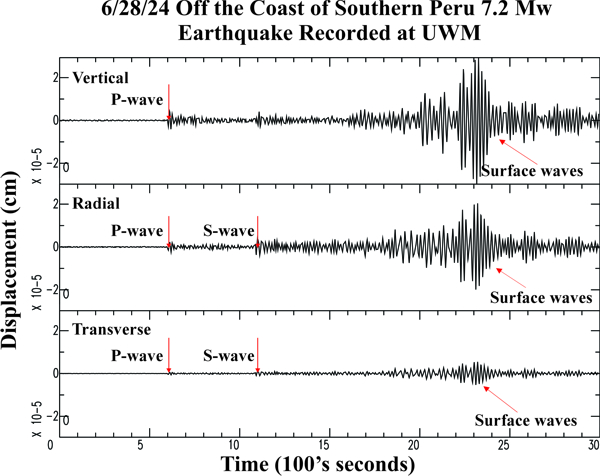
Seismogram Explanation |
| Location: Off the Coast of Southern Peru |
P-wave: 05:46:44 UTC; 12:46:44 am CDT |
| Date: June 28, 2024 |
S-wave: 05:54:57 UTC; 12:54:57 am CDT |
| Time: 05:36:37 UTC; 12:36:37 am CDT |
The vertical axis is in units of displacement in centimeters. |
| Latitude: 15.81 S |
The horizontal axis is in units of time in seconds. |
| Longitude: 74.45 W |
The beginning of the file is the origin of the event. |
| Magnitude: 7.2 Mw |
|
| Depth: 17.5 km |
|
| Distance: 60.16 degrees (~4,072 miles from Milwaukee) |
|