| Earthquake Details |
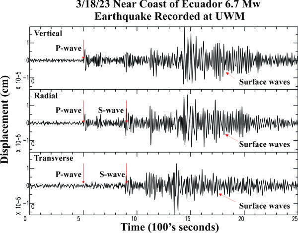
Seismogram Explanation |
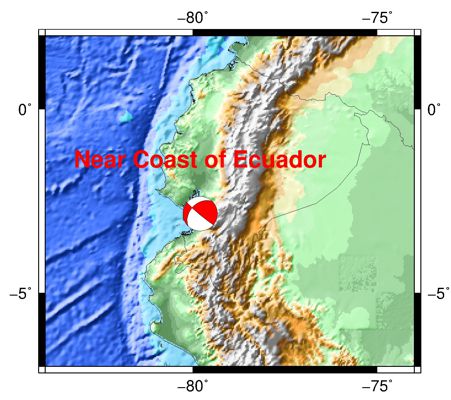
| Location: Near the Coast of Ecuador |
P-wave: 17:21:13 UTC; 12:21:13 pm CDT |
| Date: March 18, 2023 |
S-wave: 17:27:57 UTC; 12:27:57 pm CDT |
| Time: 17:12:23 UTC; 12:12:23 pm CDT |
The vertical axis is in units of displacement in centimeters. |
| Latitude: 2.85 S |
The horizontal axis is in units of time in seconds. |
| Longitude: 79.80 W |
The beginning of the file is the origin of the event. |
| Magnitude: 6.7 Mw |
There was a 7.4 event about 9 hours later roughly in the same area. |
| Depth: 20.5 km |
This event caused some damage and at least 13 deaths. |
| Distance: 46.50 degrees (~3,148 miles from Milwaukee) |
|