
Maps
The AGSL has over 520,000 maps of all types covering the world at a wide range of scales. Included are the major national topographic series, navigational charts detailing the Earth’s coastlines and a wealth of thematic maps treating the full range of physical and human factors.
- The oldest original map in the AGSL holdings is the MappaMundi, by Venetian cartographer Giovanni Leardo, which dates from 1452.
- Over 20,000 maps can be view in the AGSL’s Digital Map Collection.
- Korean map Daedongyeojido at UWM
- Milwaukee, Wisconsin Sanborn Fire Insurance maps are also online here.
- Guide to online fire insurance maps in the US, Canada, Cuba and Mexico.
- AMS and GSGS indexes
- Maps loaned by the American Geographical Society to the Peace Conference at Versailles, 1918-1919: Peace Treaty Maps AGSL
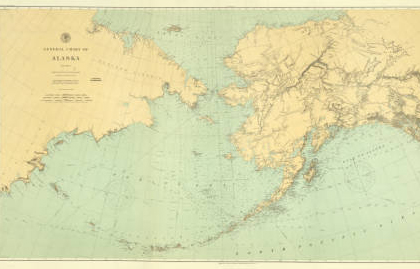
Charts
The AGSL cartographic collection includes navigational charts at a variety of scales and publication dates, produced by the following agencies:
- Matthew Fontaine Maury winds and currents charts (click here for holding information or for Maury charts in the digital collections).
- United States Coast and Geodetic Survey
- National Ocean Service
- United States Navy Hydrographic Office
- National Oceanic and Atmospheric Administration (NOAA)
- The Defense Mapping Agency (DMA) (now the National Imagery and Mapping Agency)
- Federal Aviation Administration (FAA)
- Military Silk Maps (list of holdings)
- Manuscript maps of Captain James Cook
The collection also includes nautical charts produced by foreign countries including:
- Argentina
- Australia
- British Admiralty
- Brazil
- Chile
- Denmark
- Estonia
- Finland
- France
- Germany
- Italy
- Japan
- Mexico
- Netherlands
- Norway
- Peru
- Poland
- Portugal
- Russia
- Spanish
- Swedish
- USSR
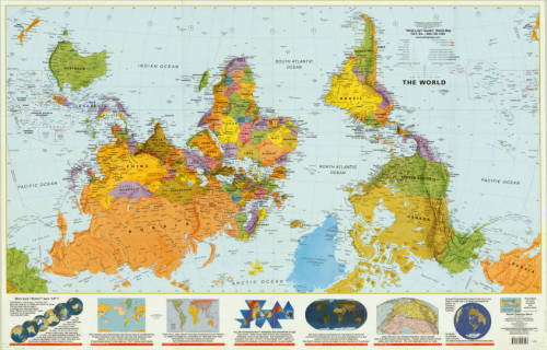
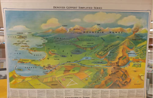
Wall Maps
The AGSL takes efforts to preserve wall maps and holds a collection of nearly 700 maps. Wall maps were once the main stay of the classroom. Now these beautifully constructed maps are becoming more difficult to find. A small selection of wall maps are available for viewing at the Digital Wall Map Collection.
View wall maps held at the AGSL:
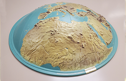
Raised Relief 3D Maps
The AGSL has many of these three-dimensional models of the terrain. A raised-relief map or terrain model is a three-dimensional representation, materialized as a physical artifact, usually of terrain. When representing terrain, the elevation dimension is usually exaggerated by a factor between five and ten; this facilitates the visual recognition of terrain features.
AGSL raised relief map finding aid
Atlases
The Library contains nearly 15,000 atlases ranging from 15th century editions of Ptolemy’s Geographia to the most modern compilations in paper or digital format.
The rare atlas collection consists of over 1,500 volumes of world and regional atlases. This collection contains classic world atlases, beginning with three versions of the 1573 Ortelius atlas and includes works by Gerardus Mercator, Gerard de Jode, J. J. Jansson, Willem Janszoon, Joan Blaeu, Nicolas Sanson, to name only a few. Also included is a collection of early Dutch, French and English marine atlases, and approximately 430 U.S. state, county and city atlases from the nineteenth century. The UWM Libraries are currently working on a “recataloging” project to get atlases cataloged online. Atlases may be searched in the card catalog or online using Search@UW.
The Milwaukee, Wisconsin Sanborn Fire Insurance Atlases for 1894 and 1910 are now online through the UWM Libraries Digital Collections. Click here to view them.
Some atlases not entirely cataloged online:
- U.S. Fire Insurance Atlases held at AGSL
- 19th Century U.S. Plat Atlases held in the AGSL
- Note: AGSL has numerous other plat maps not bound in atlases. These are cataloged online or in the card catalog. See staff for assistance.
- Fire Insurance maps/atlases online in the US, Canada, Cuba and Mexico
Globes
The AGSL collection includes over 253 globes, most on permanent display. Several globes are of historical value, including a 1613 Hondius globe and an 1831 matched pair of Wilson globes, plus a variety of thematic, special purpose, lunar, planetary and celestial globes. The largest and most spectacular is a rare example of the fifty inch “President’s globe,” produced by the OSS during World War II for President Roosevelt and Prime Minister Churchill.