Check out our Web-based Resources and lesson plans for K-12 educators made by local K-12 teachers using materials found at the American Geographical Society Library.
K-12 Resources
| Image | Title | Author | StoryMap / Website | Abstract | Grades | Subjects |
|---|---|---|---|---|---|---|
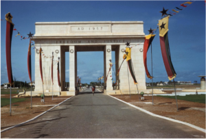 | Decolonization and Independence in 20th Century Africa | Nicholas Gerard-Larson | StoryMap Link | Abstract Link | 9-12; high school | Decolonization; Africa |
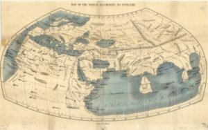 | World Explorers | Jennifer Yourd | StoryMap Link | Abstract Link | 6-8; middle school | World Explorers |
 | La geografía del desplazamiento climático | Danielle Chaussée | StoryMap Link | Abstract Link | 9-12; high school | climate change; in Spanish |
 | I Am, Where I’m From | Erin Sivek | StoryMap Link | Abstract Link | 6-8; middle school | refugees; immigrant education |
 | I Am, Where I’m From, Part 2 | Erin Sivek | Abstract Link | Abstract Link | 6-8; middle school | refugees; immigrant education |
 | Project Lakefront | Logan Duerst | StoryMap Link | Abstract Link | 6-12: middle school; high school | freshwater lakes |
 | Origins of ASL | Aspen Kuk | StoryMap Link | Abstract Link | 9-12; high school | ASL; American Sign Language |
 | History of North American Sign Languages | Aspen Kuk | StoryMap Link | Abstract Link | 9-12; high school | Native Americans; Sign Languages |
 | European Colonialism | Lukas Wierer | StoryMap Link | Abstract Link | 9-12; high school | Africa; European Colonialism |
 | The Untaught History of Afro-Latinos | Arleth Villagran | StoryMap | Abstract Link | 9-12; high school | Afro-Latinos; history |
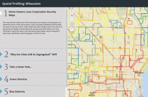 | Spatial Profiling: Milwaukee | Nathan Conn | StoryMap Link | 9-12; high school | Milwaukee; demographics; racism | |
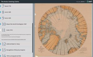 | The Arctic: Evolving Claims | Gregory F. Roman | StoryMap Link | Abstract Link | 9-12; high school | Arctic; geopolitics |
 | Arctic: Indigenous People | Gregory F. Roman | StoryMap Link | Abstract Link | 3-8; elementary school; middle school | Arctic; Indigenous People |
 | Mapping the Arctic | Gregory F. Roman | StoryMap Link | Abstract Link | 3-12; elementary school; middle school; high school | Arctic; mapping; cartography |
 | Who was Louise Boyd? | Gregory F. Roman | StoryMap Link | Abstract Link | 6-12; middle school; high school | Louise Boyd; women explorers; Greenland; Poland |
 | Mapping the World | Gregory F. Roman | StoryMap Link | Abstract Link | 3-12; elementary school; middle school; high school | world; mapping; cartography |
 | Peary’s Polar Expeditions | Gregory F. Roman | StoryMap Link | Abstract Link | 9-12; high school | Polar Expeditions; Robert Peary |
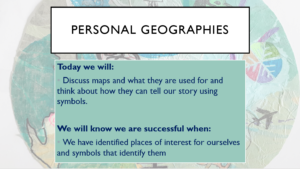 | Personal Geographies inspired by Medieval Mappa Mundi | Annie Kassens | Abstract Link | Abstract Link | 4-5; elementary | Art; mental map; personal geographies |
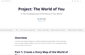 | The World of You | Sarah Harley | Abstract Link | Abstract Link | 9-12; high school | English; Personal geographies; refugees; immigrant education |
 | Mapping Our World: An Introduction to the Art of Cartography | Hodna Nuernberg | Abstract Link | Abstract Link | 3-5; elementary; French immersion | Art; geography; artistic media |
Mapping Our World: An Introduction to the Art of Cartography
As long as people have existed, maps have served an important purpose as a teaching tool, helping us organize knowledge and understand our world.
In this six-lesson cartography unit, students view and engage with maps from the American Geographic Society Library’s collection. They are introduced to cartography, explore a variety of artistic media and techniques, and investigate what maps can tell us about the people who made them.
The World of You
Maps have long been a source of interest and intrigue. Early maps were mostly pictorial and often inaccurate. Over the years, through the use of satellite imagery, maps have become more and more accurate. Although maps are now widely available online, paper maps are still highly valued.
The seven lessons presented here are designed to guide students to view maps in different ways, to move beyond seeing maps as static objective navigational tools. Through a variety of discussions, interactive experiences, and activities, students will come to a much deeper understanding of the vast field of cartography and how maps shape the way we see the world. The lessons can be used independently, with varying degrees of amplification, or as a tool to build background knowledge for the project: The World of You.
Project Lakefront
According to an article in the Smithsonian magazine, “Roughly 70 percent of the Earth’s surface is covered by water, but less than four percent is covered by lakes.” The fact that lake water seems more precious than gold is an idea that most of us don’t comprehend. Through the teaching of this lesson, students will gain a better understanding of human use, impact, and relationship with lakes. This project is the examination of municipalities located on freshwater lakes. Specifically, this project will have students research the ways societies, cultures, economies, and governments interact with the lake and shoreline. This project will encompass all aspects of social studies, as well as work on skills like collaboration, research, opinion-based writing and supporting opinions with evidence. The project is broken up into four parts that deepen their knowledge and understanding as it goes on. At first introducing some examples of cities with lakefront, then some creative lessons in the middle to further the students interest and creativity in the topic, and finally ending with a student-led research project. This lesson was created to be a jumping-off point, meant for educators to make their own leaps of discovery and learning.
Who I Am, Where I’m From (Part 2)
In this cross-curricular Social Studies and English Language Arts unit, immigrant and refugee students will explore maps of their homelands from the AGSL Digital Collections. Students can use pre-selected maps or search for maps in the collections. Students will perform research using online databases and/or other primary sources to learn how and why their homeland’s names and borders have changed over time. During this unit, students will also learn new academic vocabulary while gaining insight into how people in power have changed our world.
Personal Geographies (inspired by Medieval Mappa Mundi)
Students are challenged to look at maps from an artistic perspective by investigating several examples that go outside the standard geographical use of a map. This lesson starts with investigating symbols, to thinking about personal places of experience and interest, to finally creating a map of their own based on their exploration. The layout of their personal geography map is loosely inspired by medieval Italian mappa mundi created by Giovanni Leardo.
Decolonization and Independence in 20th Century Africa
With the end of the Second World War in 1945, colonial troops who had fought in the conflict returned home and joined movements demanding independence from European empires. This process of decolonization saw increasing calls for self-government, national pride, and an end to colonialism. Over the next three decades, dozens of countries in Africa and Asia achieved independence through a variety of different strategies. This project focuses on the story of decolonization in four African countries: Ghana, the Democratic Republic of Congo, Tanzania, and Algeria. Additionally, the project also showcases important historical and geographical skills—visual thinking, spatial thinking, and critical thinking—that both students and teachers will find useful in helping to analyze and work with primary sources, especially maps.
World Explorers
This StoryMap has curriculum themed on World Explorers appropriate for middle school students Grades 6-8. The curriculum includes lessons on a broad overview of the history of map-making, and how it influenced world exploration, as well as some key explorers throughout history, and the motivations and consequences of their expeditions.
La geografía del desplazamiento climático
This StoryMap uses AGSL maps and photos, as well as current data on extreme climate events, to lead students through an exploration of five major causes of climate change displacement. For each extreme climate event, the students will also explore a case study. This StoryMap is designed for an International Baccalaureate Spanish course and it includes interpretive reading activities, which provide practice for the IB exam (the activities will be linked in the fall of 2021). Although it is designed for an IB course, it can be used in any advanced Spanish course. This StoryMap includes a handout that students can use to reflect / answer the questions in the StoryMap. The handout can be found as a button at the top of the StoryMap page. All questions that are found on the handout are typed in blue on the Storymap. NOTE: This Storymap does not include a summative assessment because it is only one part of a larger unit that encompasses a broader scope of immigration issues.
I Am, Where I’m From

In this unit, students will analyze maps of their homelands from the AGSL Digital Collections dated as recently as 2018 to as far back as 1721. Specifically, students will use three pre-selected maps that include their home countries’ region. After
identifying and writing about their homeland, they will study how its name and borders have changed through the time period of these maps. Students will then perform research using online databases to learn how and why these changes
occurred. During this unit, students will also acquire new academic vocabulary while gaining insight into how people in power have changed our world.
Origins of ASL & History of North American Sign Languages

The final goal is for students is to not only read the StoryMaps, “The History of Sign Languages in North America” and the “The Origins of ASL,” but annotate as they read and answer text dependent questions connected to the material. The teacher will demonstrate annotating the first portion of both StoryMaps, then have the students complete annotating and reading the rest of the StoryMaps on their own. All of these steps will be done virtually, so students can work at their own pace, while still meeting the deadline.
European Colonialism

This unit will be used in sections of Ethnic Studies at the high school level. It focuses on European colonialism, specifically the impact that European colonization has had on formerly colonized nations. Students should examine the timelines and watch accompanying video clips; then, using the AGSL maps, connect that content with the given map. Following these two units, the students can further examine the role that colonization and global capitalism played in the formation of racist ideas that stick with us today.
The Untaught History of Afro-Latinos

Afro-Latinos is a topic that rarely gets covered in Spanish classes in the United States, and it is important to the history of Latin America. This StoryMap allows students to easily navigate information even if there isn’t a teacher physically there to help. The expectation is for students to practice their close reading skills and answer text-dependent questions as they read along.
Spatial Profiling: Milwaukee

An interactive Home Owners Loan Corporation map that shows how Milwaukee was divided based on race and class during the 1930’s under the New Deal mortgage program. There is also information on Milwaukee’s place in the Civil Rights movement to call attention to these issues in the 60’s and 70’s and how these neighborhoods are still affected today by food deserts.
The Arctic: Evolving Claims

This story map traces the evolution of competing claims made by various countries in the Arctic region by using various resources from the American Geographical Society Library.
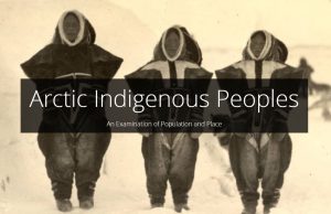
Arctic: Indigenous People

This story map explores the culture of Arctic indigenous peoples through resources found in the American Geographical Society Library archives.
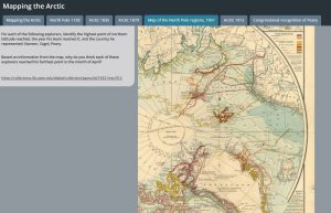
Mapping the Arctic
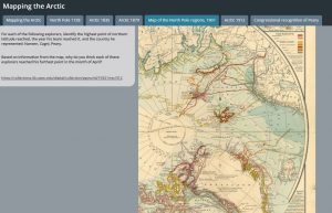
This story map incorporates various maps from the American Geographical Society Library and traces the evolution of Arctic mapping.
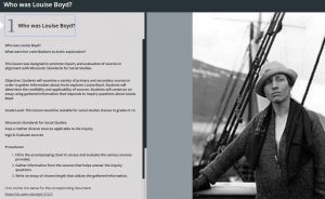
Who was Louise Boyd?

This story map utilizes resources from the American Geographical Society Library and encourages an examination of Louise Boyd’s contributions to polar exploration.
Mapping the World

This story map uses various maps from the American Geographical Society Library to examine the advances made in accurate world mapmaking.
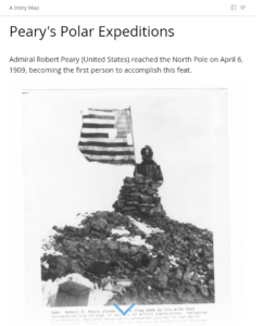
Peary’s Polar Expeditions
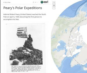
This story map utilizes resources from the American Geographical Society Library to examine Admiral Robert Peary’s various polar expeditions leading to his successful reaching of the North Pole in 1909.