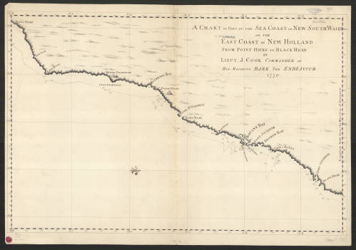
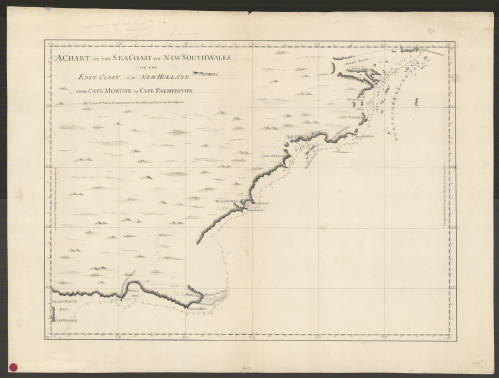
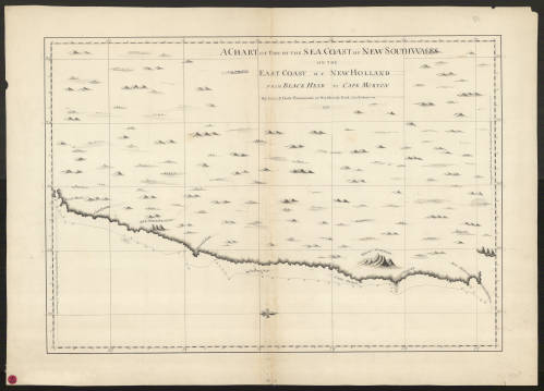
The renowned English explorer, James Cook (1728-1779), commanded three voyages of discovery focusing on the Pacific Ocean, between 1768 and his death in Hawaii in 1779. The first, 1768-1771, on board the Endeavour, with Cook holding the rank of Lieutenant in the Royal Navy, was commissioned principally to take scientists to Tahiti for the observation of the transit of Venus, June 3, 1769. With this successfully completed, Cook explored the neighboring islands and then sailed to New Zealand, where, for the next six months, he undertook its exploration and charting. Before returning home, however, he proceeded to explore and map the previously uncharted east coast of Australia. A set of four manuscript charts of this survey are preserved in the AGSL. The charts, drawn at a scale of 1° of longitude = 4 inches, are as follows:

Accompanying Cook on his second and third voyages was George Vancouver (1757-1798) who would later gain fame commanding his own expedition along the northwest coast of America, 1791-1795. Vancouver first joined Cook as an able seaman during the second voyage and was promoted to midshipman near the beginning of the third. Only three of his maps from the Cook voyages still exist, perhaps because his others went with him during his own voyage and were never returned. The single Vancouver manuscript chart surviving from Cook’s third voyage is a map of Alaska, the Bering Straits and part of Asia which has been preserved in the AGS Library since 1887:
Chart of the NW Coast of America and part of the NE of Asia with the track of his Majesty’s Sloops Resolution and Discovery, from May to October 1778, by George Vancouver. [Scale ca. 1:2,000,000; drawn on 2 sheets] (not online)
An objective of Cook’s third voyage was to penetrate the Bering Straits and search for a passage from the Pacific Ocean to the Atlantic Ocean by sea. He was met instead by an impenetrable barrier of ice which forced his retreat. Cook died soon after that in a skirmish with Hawaiian native peoples.