Maps for a Better Lake Michigan
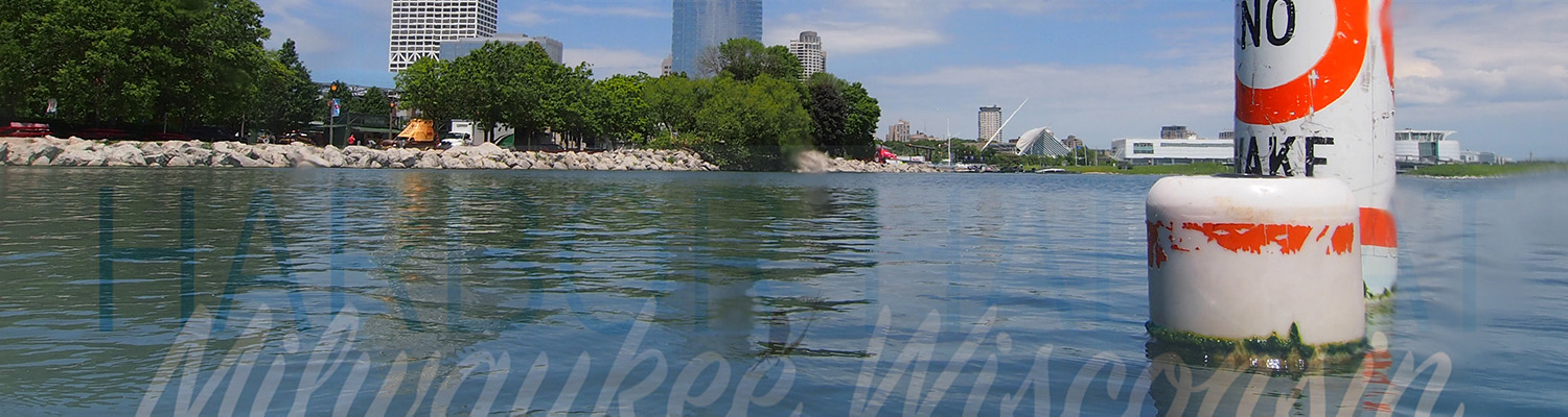
We’re diving deeper to improve the world’s largest freshwater system – beginning at home in the Milwaukee Harbor. Mapping fish habitats helps protect and restore vibrant wildlife populations in the heart of urban Milwaukee.
Charting Life Under Water
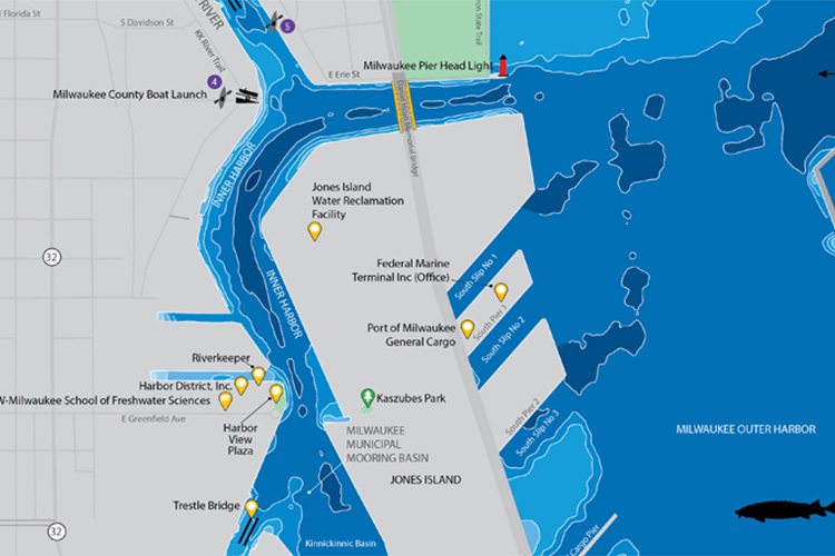
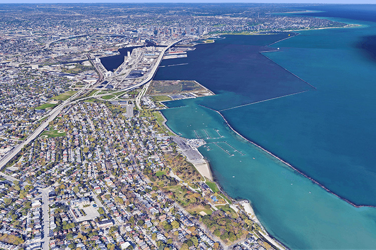
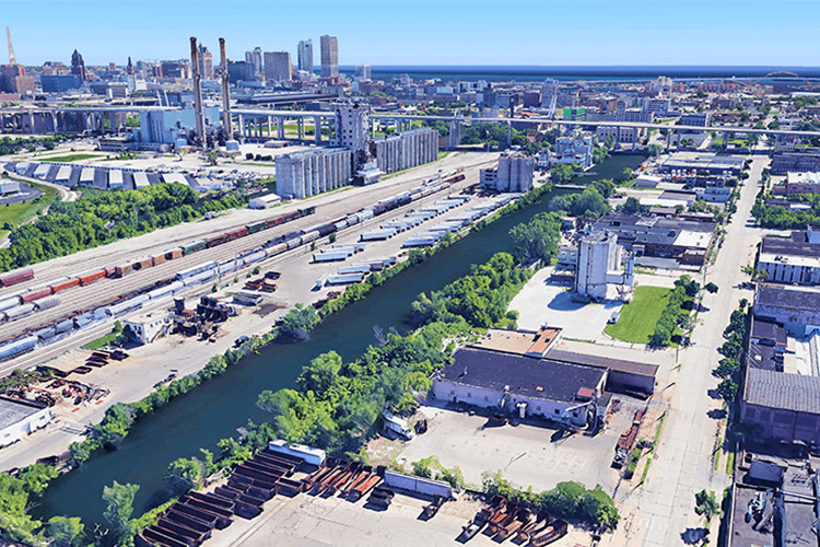
Researchers from the School of Freshwater Sciences mapped 42 miles of Milwaukee’s lower estuary, where Lake Michigan meets the city’s southern waterways, to find the homes of freshwater fish. Designed by Associate Professor Kim Beckmann, the resulting maps show wildlife teeming below the surface of this industrial harbor. The maps are educating the public and supporting clean-up efforts throughout the area, as activities are underway to connect and expand the “habitat hotspots” researchers discovered.
How the Maps Were Made
Learn more about how the project came to be and the process of making the maps and plans for future maps.
Get Maps
Order copies or find out where they are on display. Educators and wildlife restoration groups can obtain maps free of charge.
How Maps are Helping Restore the Harbor
The Milwaukee Harbor is an EPA “area of concern” because of its high levels of industrial waste. As governmental agencies, researchers and nonprofits seek to get our harbor off that list, the maps on this page help them identify which interventions will be most effective. The harbor maps also spurred the creation of a consortium of organizations that can take on large-scale improvement projects and fueled additional grant proposals to map more areas and expand habitats. Finally, the maps are being distributed to the public to inspire residents and visitors to be stewards of our local ecosystem.
Future Maps
With the Milwaukee Harbor Mapping project moving into the graphic design phase, the Fund for Lake Michigan funded a second mapping project. This new project focuses on mapping fish spawning and foraging habitat in the Lake Michigan harbors of the Wisconsin communities:
- Algoma
- Kewaunee
- Two Rivers
- Manitowoc
- Sheboygan
- Port Washington
- Racine
- Kenosha
Each of the four harbors is smaller than the Milwaukee Harbor, with smaller river input. The diversity of size of the several proposed harbors along with Milwaukee affords an opportunity for deeper understanding of how these “manufactured” ecosystems function. Each harbor at its current state has lost its original coastal wetland due to conversion of multiple purposes with significant industry influence. The maps will help stakeholders in each community to enhance ecosystem services so that diverse recreational opportunities—and a recreational economy—can flourish alongside the industries that employ area residents.
The project began in 2018 and is currently ongoing. As with the Milwaukee Harbor project, both technical Graphical Information System (GIS) maps and more accessible public maps will be produced.


Resources
- City of Milwaukee
- Discovery World Science and Technology Center
- Fund for Lake Michigan
- Harbor District, Inc
- Milwaukee County Parks
- Milwaukee Metropolitan Sewerage District
- Milwaukee Riverkeeper
- National Oceanographic and Atmospheric Administration-Office of National Marine Sanctuaries
- Port Milwaukee
- U.S. Army Corps of Engineers
- U.S. Geological Survey Wisconsin
- University of Wisconsin-Milwaukee Peck School of the Arts
- University of Wisconsin-Milwaukee School of Freshwater Sciences
- Urban Ecology Center
- Wisconsin Coastal Management Program
- Wisconsin Department of Natural Resources
- Wisconsin Sea Grant
- These Unique Maps Show What’s in Milwaukee Harbor (Milwaukee Magazine)
- New Maps for the Milwaukee Harbor Shows What Lies Beneath the Surface (Great Lakes Echo)
- Unique New Maps Show What’s in Milwaukee Harbor (AWealthofNarture.org)
- New Maps Show What Lies Beneath the Water in the Milwaukee harbor (UWM Report)
- Amid City’s Grit Grad Maps Wild Underwater World of Milwaukee’s Estuary (UWM Report)
- Kim Beckmann highlighted by Avenza Systems Inc.
- A Map to Recovery (UWM Research Report)
- Goal of UWM Habitat Study is to Help Restore Fisheries in River (Milwaukee Journal Sentinel)
Get Maps
The full set of Milwaukee Harbor maps consists of one large Main Harbor Map (measuring 36” x 44”) and four smaller Focus Maps (each measuring 24” x 36”) that zoom in on the six “habitat hotspots” with additional detail and information.
Download Low-Resolution Map Files
Order High Quality Poster Prints
These maps can be provided on high quality paper or on a more durable vinyl for outdoor use, while quantities last.
To inquire about how your organization can get the maps please contact Liz Sutton at emsutton@uwm.edu. Please provide your name and information about the organization with whom you work.