Weeks One and Two of the 2021 UW-Milwaukee Archaeological Field School
During the first two weeks the students in the archaeological field school participate in lectures on identifying cultural material and culture history of Wisconsin. They also receive instruction on how measure distance using their steps, orienteering with a compass, and then combining those skills to produce a sketch map. Field school students conducted Phase I archaeological surveys to relocate existing and identify new archaeological sites in agricultural fields and in the Pike Lake Unit, Kettle Moraine State Forest using the distance measuring techniques and compass training they have received. They learned also how to interpret different soil horizons. Daniel Joyce gave a demonstration to the students of ground penetrating radar that is used by archaeologist. Now that they have conducted Phase I survey, in the upcoming weeks they will conduct archaeological excavations at an archaeological site to learn the finer skills of archaeological excavation.
We would like to thank Richard Kubicek, Wisconsin DNR archaeologist; Rob Wessberg, superintendent of the Pike Lake Unit-Kettle Moraine State Forest, Anne Korman, superintendent of the Southern Unit-Kettle Moraine State Forest; and Mac Dempsey, tenant farmer of DNR property in the Southern Unit-Kettle Moraine State Forest for allowing us to conduct our Phase I surveys on Wisconsin DNR property.
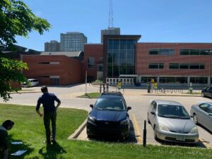
Figure 1. Students are using the distance measuring and compass orienteering methods to generate a sketch map of the parking lot north of Sabin Hall at the University of Wisconsin-Milwaukee.
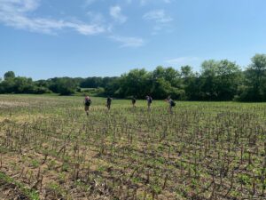
Figure 2. Field school students conducting Phase I pedestrian/walkover survey of an agricultural field on Wisconsin DNR property near Eagle, WI.
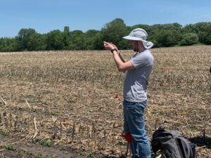
Figure 3. Field school student Zachary Wetter getting a compass bearing to measure the distance to the field edge of an identified archaeological site (red pin flags mark the site) in a field on DNR property near Eagle, WI.
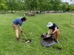
Figure 4. Field school students Sicily LaLicata and Zachary Wetter excavate a shovel test probe in the Pike Lake Unit-Kettle Moraine State Forest picnic area.
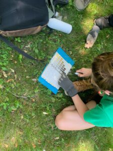
Figure 5. Field school student Emily Hanson is using a Munsell Soil Color Chart to determine the color of a soil horizon in a shovel test probe.
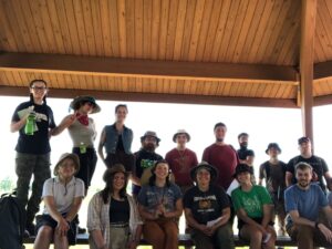
Figure 6. Field school group photo at the Lizard Mound County Park, Washington County, Wisconsin.