Overview
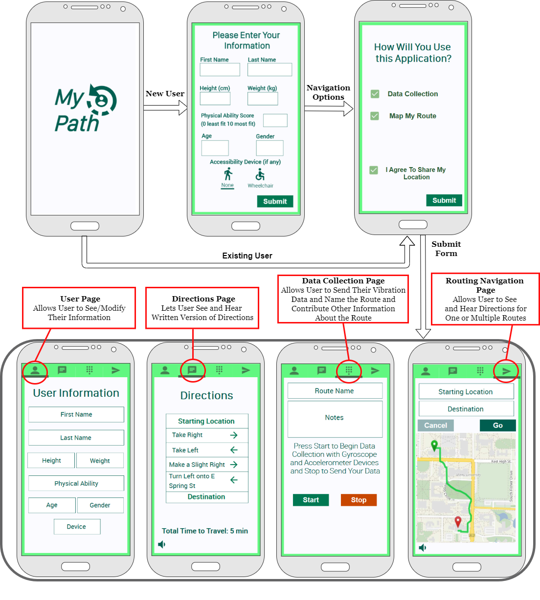
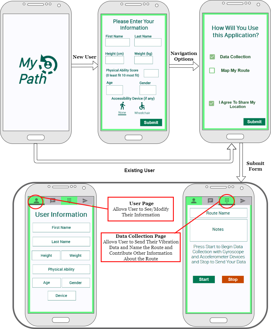
People with ambulatory disabilities are required to make numerous choices regarding how, where, and when they access communal spaces each day to remain independent in the community and to maximize their participation (e.g., navigation and routing decisions for identifying optimal pathways, etc.). However, the information needed for decision-making related to best routing and navigation is often elusive and too generic. The MyPath project proposes to develop a software system that will run on any smartphone to a) collect the vibration generated by different paths across the built environment, b) classify path accessibility, and c) create personalized point-to-point routes with step-by-step navigation information. In summation, we are developing a mobile application that will use community-member collected data to classify and describe the accessibility of various outdoor routes in the community.
For an overview of prior project work and the technical aspects of the project, please visit: http://www.routemypath.com/
The Goal: Accessible Routing Using Smart Crowd-Sensed Surface Classification for Wheelchair Users
The goal of this project is to enable people with ambulatory disabilities to successfully participate in the community by facilitating equal access to all public areas, such as public buildings, parks, roads and sidewalks, and even beaches.
Objectives
The project’s objectives include the development of a Smart App prototype for data collection and classification of outdoor path accessibility, a personalized accessible routing and navigation function for the App prototype using path accessibility data, and complete preliminary validation of the app for functionality, usability, and psychometrics.
What is the R2D2 Center (UWM) Doing?
The MyPath team has begun an initial outreach to Participatory Action Research (PAR) participants, with the goal of engaging PAR members in discussions on community accessibility factors. From there, the team will conduct focus-group meetings with community advisors to discuss app formatting and inclusion needs. Future data collection will then revolve around the collection of community terrain-based data from individuals with mobility impairments.
Background
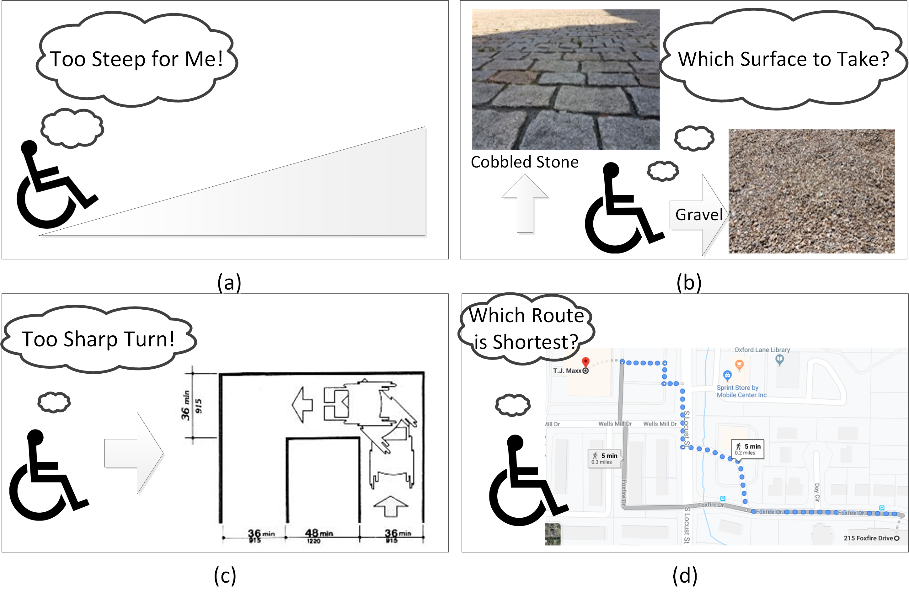
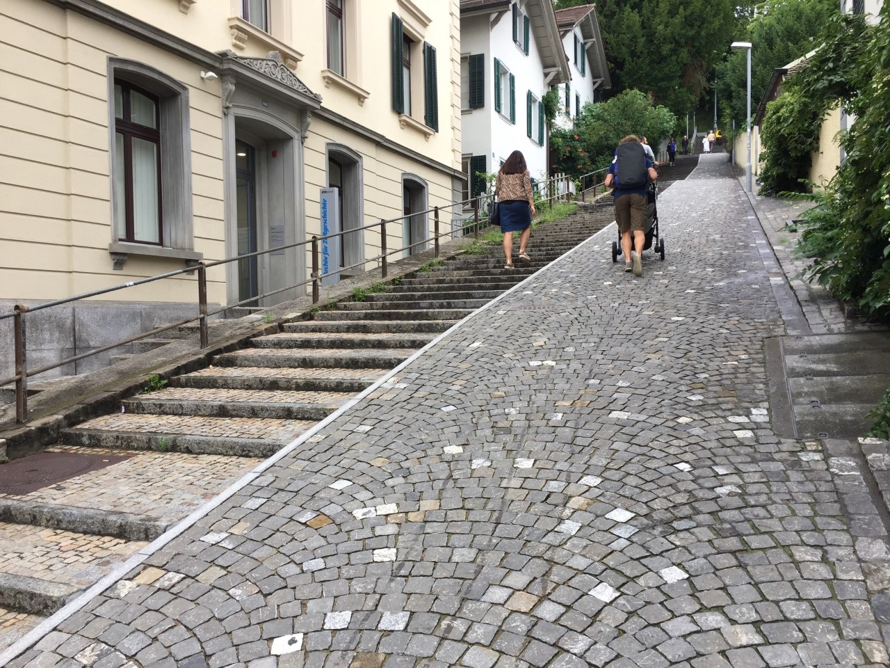
Traveling on city streets, especially in unfamiliar surroundings, can be challenging for wheelchairs users due to environmental barriers. Uneven surfaces, stairs and steep slopes, absence of curb-cuts and crosswalks, and weather conditions can prove to be barriers for people using wheelchairs. These barriers can lead to tardiness, inability to reach a destination, and overall frustration and distress from those trying to navigate independently with their wheelchair. Individuals in wheelchairs may spend several hours researching and planning navigation routes which can lead to the decision not to go out at all. The ability to effectively and conveniently identify optimal routes is essential for a successful community participation. This is particularly true for new wheelchair users, individuals in unfamiliar areas, and individuals with injuries or disabilities which may require greater assistance.
This project aims to help people with mobility disabilities achieve equal access to all public areas, such as public buildings, parks, roads and sidewalks and beaches. Surface quality is a major aspect of travel in a wheelchair, and the preferred surfaces for wheeled mobility must be even, firm and smooth while generating adequate friction. When creating software for wheelchair users, something that is often overlooked is the overall nature of the potential paths taken. Personalized routing supports that collect and notify PWD a range of pathway characteristics are required to help initiate informed decisions.
Despite the wide variability of accessibility features needed by PWD, no organized scientific study has been carried out to relate surface preferences of users while at the same time generate maps for them that matched wheelchair accessible routes to their needs. Also, researchers have not considered the health impact of users and their preferences while designing accessible routes.
Fall 2021 Progress: I-CORPs Interviews
Anticipated Outcomes and Products
While work on the study is currently underway, the researchers within the study team project that the MyPath project will lead to wheelchair users being better equipped to face the challenges of navigating the unfamiliar surroundings while using the MyPath app. It is also projected that given the study methods and data collection the crowdsourced data collected through the MyPath app will be available through OpenStreetMap (OSM) for use by city planners and designers, engineers, and other stakeholders. Finally, the study’s technique of path labelling will potentially become an accepted method of identifying accessible and inaccessible features of community terrains.
Products created as a result of the study will include the MyPath app for accessible routing and navigation, a wheelchair user-based training of the MyPath app, live outcomes database in the form of OSM, and marketing and outreach materials needed to promote the app.
Project Team
- Vaskar Raychoudhury, University of Miami – Co-Principal Investigator
- MD Osman Gani, University of Maryland, Baltimore – Co-Principal Investigator
- Roger O. Smith, University of Wisconsin-Milwaukee – Co-Principal Investigator
- Lauren Selingo, University of Wisconsin-Milwaukee – R2D2 Center Project Lead
- Hanna Noyce, University of Wisconsin-Milwaukee – R2D2 Center Staff Project Team Member
- Emily Olejniczak, University of Wisconsin-Milwaukee – R2D2 Center Student Staff Project Team Member
- Md Fourkanul Islam, University of Maryland, Baltimore – Student Staff Project Team Member
- Rochishnu Banerjee, University of Miami – Student Staff Project Team Member