
| Earthquake Details | Seismogram Explanation |
|---|---|
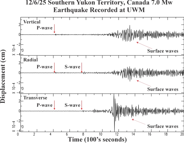
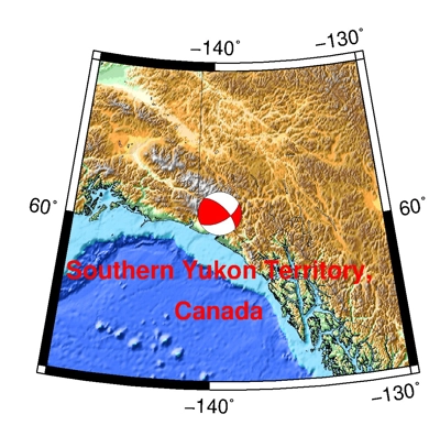
| Location: Southern Yukon Territory, Canada | P-wave: 20:48:42 UTC; 2:48:42 PM CST |
| Date: December 6, 2025 | S-wave: 20:54:16 UTC; 2:54:16 PM CST |
| Time: 20:41:49 UTC; 2:41:39 PM CST | The vertical axis is in units of displacement in centimeters. |
| Latitude: 60.36 N | The horizontal axis is in units of time in seconds. |
| Longitude: 139.55 W | The beginning of the file is the origin of the event. |
| Magnitude: 7.0 Mw | |
| Depth: 11.5 km | |
| Distance: 35.15 degrees (~2,379 miles from Milwaukee) |