
| Earthquake Details | Seismogram Explanation |
|---|---|
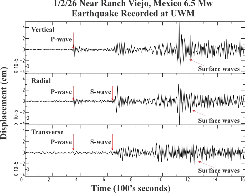
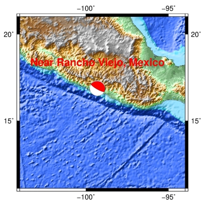
| Location: Near Rancho Viejo, Mexico | P-wave: 14:04:08 UTC; 8:04:08 AM CST |
| Date: January 2, 2026 | S-wave: 14:08:53 UTC; 8:08:53 AM CST |
| Time: 13:58:18 UTC; 7:58:18 AM CST | The vertical axis is in units of displacement in centimeters. |
| Latitude: 16.90 N | The horizontal axis is in units of time in seconds. |
| Longitude: 99.30 W | The beginning of the file is the origin of the event. |
| Magnitude: 6.5 Mw | |
| Depth: 11.5 km | |
| Distance: 27.92 degrees (~1,890 miles from Milwaukee) |