
| Earthquake Details | Seismogram Explanation |
|---|---|
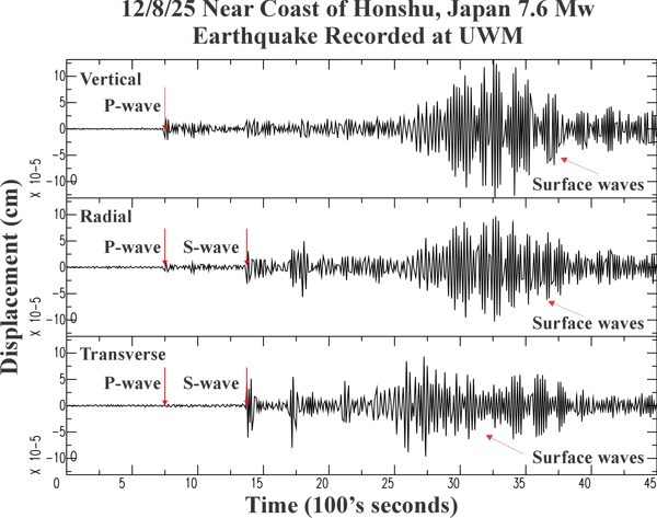
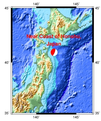
| Location: Near Coast of Honshu, Japan | P-wave: 14:27:40 UTC; 8:27:40 AM CST |
| Date: December 8, 2025 | S-wave: 14:38:05 UTC; 8:38:05 AM CST |
| Time: 14:15:11 UTC; 8:15:11 AM CST | The vertical axis is in units of displacement in centimeters. |
| Latitude: 40.96 N | The horizontal axis is in units of time in seconds. |
| Longitude: 142.19 # | The beginning of the file is the origin of the event. |
| Magnitude: 7.6 Mw | |
| Depth: 40.5 km | |
| Distance: 84.62 degrees (~5,728 miles from Milwaukee) |