400 Year Old Map of Mexico in Nahuatl
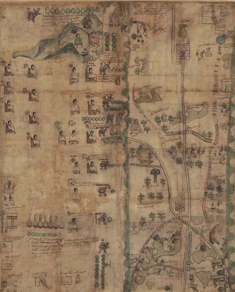
From Remezcla: The United States Library of Congress recently added a 400-year-old piece of Mexican history to its online collection, one that helps further illustrate a key moment in the history of Mexico. The Codex Quetzalecatzin, a map made in 1593 by the indigenous Nahua peoples of Mexico around the time of first contact with the Spanish Empire, has been digitized for the library’s collection, and it can be viewed online here.